Storm Potential Increases As We Head Into December
- Nov 27, 2017
- 2 min read
Recently, the weather here in the US has been pretty bland, with a lack of storms. This is mostly due to the zonal jet stream we have been seeing over the past few weeks. This zonal flow looks to stay in place for a little over a week longer.

Luckily for you snow lovers in the east, this pattern looks to change soon. By mid to late next week, a big cold front looks to dive south into the eastern US. As of now, it looks like the jet stream will form and maintain a sharp dip in the east, and will finally go into a meridional flow.

A meridional jet stream has much sharper rises and dips than a zonal jet stream does, and tends to promote more storm activity.

The jet stream flow doesn't have everything to do with whether or not we get a big storm though. The AO and NAO are also big factors in creating cold and stormy weather, especially in the central and eastern US. The AO looks to sharply dip into a negative phase, and the NAO looks to slightly be in a negative phase.This will help to enforce the big eastern trough, and will allow arctic air to dive into the central and eastern US. (For more information on the AO and NAO, visit this great website: State Climate Office of North Carolina.)


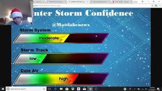
So, could we be seeing some snow in the Midwest and Northeast? The answer is I'm not sure yet. Cold and unstable weather is likely as we head into late next week, but whether that lines up with a big storm is still uncertain.
I, as well as the all the members of USWC, will keep pushing out blogs and videos on the weather ahead, so make sure to keep coming back!


Comments