

Hurricane Maria and counting!
- Sep 21, 2017
- 1 min read
Hurricane Maria has impacted the caribbean islands heavily the past few days. Maria is now just north of Hispaniola, core/eye are disorganized at the moment.

It will eventually make the north turn she just haven't done so yet. All might be wondering after here where may Maria go next? Well to start off this is a complicated forecast for us folks here on the east coast. the GFS model continues to bring Maria Out to sea same with the majority of the guidance.

GFS model suggest the remnants of Jose to just die off allowing the ridge to build out ahead of the next trough. IF the trough can not capture Maria, it will send her out to sea. But if it does capture her the trough may bring her in. Suggested by the CMC.
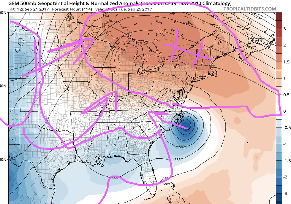
So the theme here is to just continue to monitor Maria even though she's likely to go out to sea. One more wave the USAWC are monitoring in the central Caribbean sea. If it were to develop like some of the guidance suggesting it could take what could be "Nate" to the northeast impacting Florida. Still way to early Floridans so don't worry. Just be happy about the weather you have now and enjoy your weekend!
Written by, Matthew


Comments