

Harvey rapidly strengthening in the gulf, poised to end 12 year major hurricane drought
- Aug 24, 2017
- 1 min read
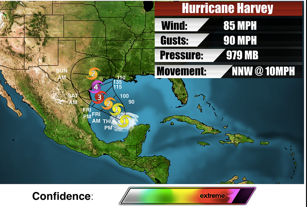
USA Weather Center's forecast cone for Hurricane Harvey
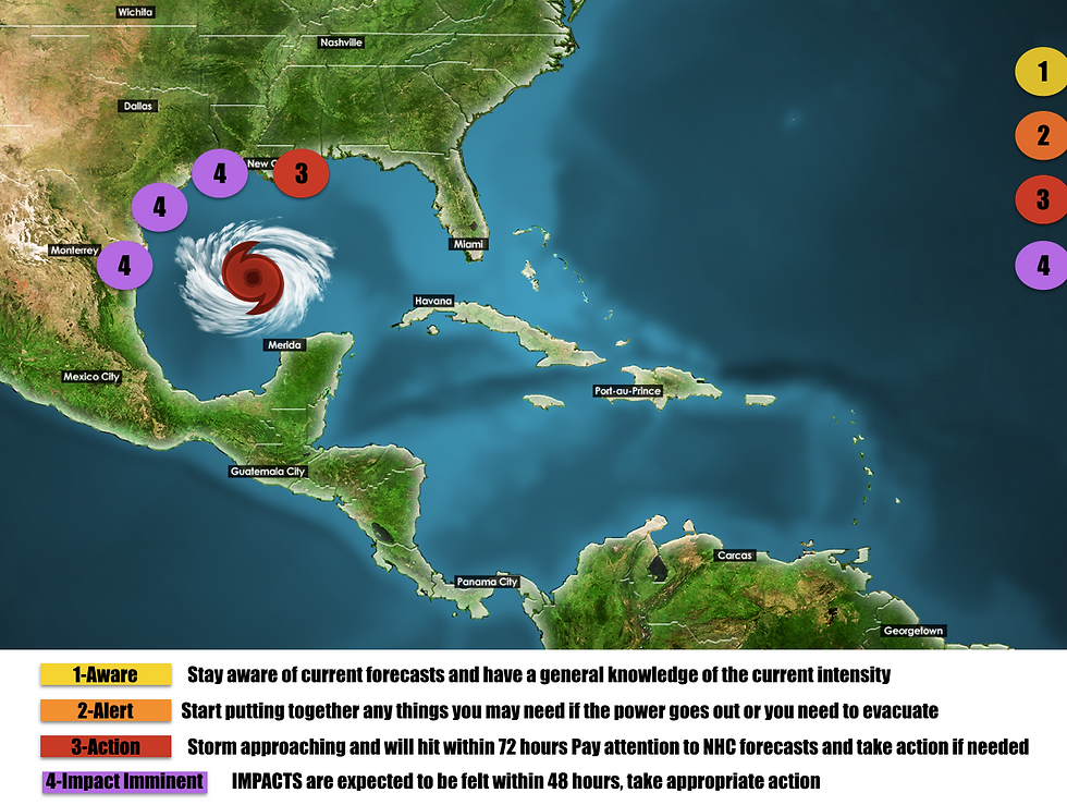
Aug 24,2017- A catastrophic situation is unfolding in the Gulf of Mexico as Hurricane Harvey is undergoing rapid intensification. From just last night our call of a category 2 making landfall was too conservative and just this morning we decided to bump it up to a low end category 4 major hurricane with the possibility of it becoming a category 5 not out of the question and that is the reason that threat levels are at a 4/4 on the Texas gulf coast
Harvey is currently in a very low shear environment over extremely warm gulf waters. This has allowed for the storm to undergo rapid intensification. It has currently been dropping 2-4mb/hr . I don't expect this pace to slow down unless it undergoes an eyewall replacement cycle which is a possibility.
Another big story with harvey is the exceptionally high rain totals as shown in the graphic below
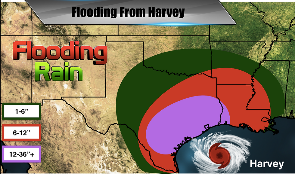
Harvey is going to be stalled out for many days over south Texas and that is gonna result in catastrophic flooding at the coastline and inland. Storm surge will also lead to flooding and I will have more on that later this evening or tomorrow morning.
Matthew will have an update on 92L and future 93L later on today. For now, if you are in south texas EVACUATE NOW!


Comments